01332 702225
34 Queen Street Derby DE1 3DS8.30am to 6.30pm Monday to Friday
Property owners are often neglectful of their boundaries until it is to late. Once the neighbour has chopped down that tree that you thought was yours it is extremely hard to put it back up again.
However if you have suitable conveyance documents and other good evdidence then it is possible to attempt to resolve many boundary disputes. Measurements can be taken and pegs knocked in to enable a boundary line to be established. Alternatively documents, photographs and drawings can be prepared to support (or disprove) a county court action for compensation and or to get a hedge or fence re-erected in its correct location.
Unfortunately the help we can give is only as good as your conveyance documents. The current Land Registry Title Plans are not very accurate and only enable boundaries to be measured to the nearest metre or so. This is due to the small scale of the plans on which the boundaries of a property are drawn and the reliance on OS plans which plot features of interest to the OS, not legal boundaries. Land Registry Title Plans are generally of little use in Court unless a property is actualy conveyed by referecne to them. It is thus well worth saving copies of old conveyance documents with measurements or drawings, if you have them. When buying a property it is wise to agree the ownership of any unclear boundaries with your prospective neighbours.
CPR 35 Right of way and boundary dispute report for Court


The claimant wanted to argue she had a right of way with a vehicle from a public car park through a splay that was persistently blocked by the land owner first with a car that was subsequently burnt out and then with bollards. Unfortunately, the judge found she had been using the splay for just short of the twenty years required for a right of way by prescription, she did not have a right of way by conveyance and that she had not acquired the right of way under Section 62 of the LPA 1925. It was found under cross examination that access to the splay had been blocked by a wall which was demolished less than twenty years ago and that an alternative access had existed at the time which had subsequently become blocked and then re-opened.
All our reports are prepared on the presumption that the matter will go to Court and come with the essential Statement of Truth and statement that the surveyor understands their duty to the Court as set out in CPR35, and the Practice Direction CPR35A.
Why is this important? If you do find yourself in Court and the report is unfavourable, and not prepared in anticipation of litigation, then you are likely to be obliged to disclose it, even though it is not favourable to you.
Furthermore, why engage a boundary surveyor who is not prepared to go to Court? We get so many instructions where the client has paid a boundary surveyor to draw a very nice plan and possibly a report, but when when asked to put their head on the block and justify their plan and report in Court they promptly turn into snowflakes and melt away. Usually, the plans they have prepared are useless as they insist on overlaying them on to the OS sheet, Land Registry Title plans, and anything but the original conveyance plan which if available is likely to be the basis of determining the boundary.
Why wouldn't you overlay a plan on to an OS sheet? As brilliant as their plans are the OS are 99% confident that any point on their 1:1250 plan will be within 1.0m of its position on the planet and that the distance between it any other object within 60m on the plan will be correct to within a metre. Beyond that the plans become increasingly inaccurate. On a 1:2500 plan 1.0m becomes 2.5m in both repect of absolute accuracy and the relationship of a point to other features.
Another issue is the OS plot features that it considers to be a boundary feature and has an hierarchy in which to choose them, so when you get a hedge stone wall and wire and post fence in close proximity the OS are likely to plot the wall or hedge even though it may not be the legal boundary.


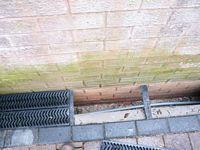
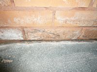
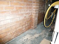
Here our Derby clients were accused of having used a neighbours garage as a retaining wall for their patio. Our surveyors were able to show that the patio was separated from the garage by a gap extending to below the garage damp proof course level. The surveyors CPR35 compliant expert witness report can be seen if you follow the link.


The client had little going for her in trying to stop the neighbour removing a hedge but fortunately she had lived at the property for seventy years and was able to offer evidence that her father had planted the hedge and that the family had maintained it since.
Derby Right of Way Dispute Survey Report


Conveyance documents showed no right of way existed and the OS sheet that an alterntaive right of way existed.


This concerned a pair of semi detached houses that were not touching. They had both extended over their garage areas so as to be almost touching. One of them trying to alter the boundary so as to be able to access the gap between them. The available conveyance plan was unhelpful as it was very vague. Fortunately there was an almost complete set of ancient boundary posts in the rear garden and the conveyance plan was clear as to responsibility for the original wall separating the front driveways.
BOUNDARY SURVEY REPORT IN RESPECT OF THE BOUNDARY BETWEEN A HOUSE AND NOW SEPERATE DEVELOPMENT PLOT.


This concerned a plot of land adjacent to a semi detached house. The land had once belonged to the house and had been sold as a development plot in about 2006. The purchaser of the land had started to construct a fence along the side of the path that lead to the house as per planning application and with full knowledge of the vendor who still owned the house at that time. The development was then abandoned, but a new owner of the house from 2009 moved the fence to a line that appeared to be randomly chosen. The movement of the fence limited the size of house that could be developed on the plot and the dispute went to trial. The owner of the development plot was somewhat over confident and failed to appoint a barrister until hours before the trial. The barrister was all at sea. The judge had originally suggested that the fence at the side of the path was correct but was persuaded to side with the new house owner. The judge seems to have been much persuaded that the conveyance plan of the development plot might exclude a demolished coal store and that the coal store was accessed from the house.
Steve Butler has been preparing boundary and right of way dispute reports for over twenty years and has been involved in hundred of cases including preparing numerous reports for use in Court, attending Court to give evidence in respect of boundary disputes, acting an as advocate before the Land Registartion Tribunal in respect of a right of way dispute and providing a binding boundary determination for two parties who wisely chose to avoid the expense of Court.
Whilst most boundaries and rights of way can be assesed with a tape measure Steve Butler has a Geomax Total Station which can record the position of numerous boundary features and most importantly how they all relate to each other in three dimensions if necessary. The data collected by the Total Station can be plotted using CAD to prepare a plan. It is sometimes possible to overlay the plan on to a copy of an original conveyance.
Independent Boundary Determination Reports
Arguing boundary caes in front of judges is an extermely expensive exercice. In the case of Harrison and Khan 2020 where Steve Butler appeard at the Birmingham Councty court for Mrs Khan the cost of the case were circa £80,000 but Mrs Khan recovered only a small proportion of these even though the boudary was decided in her favour. Steve Butler can draw up a binding boundary report with or without instruction from solciitors.
Example boundary determination report
How can your surveyor tell the judge his opinion of the boundary or right of way if they do not know the law. Steve Butler is a member of the Chartered Institution of Legal Executives and thus has a good understanding of land law, the law of contract, the law of tort, the criminal law and statutory law such as the 1832 Presciption, 1925 Law of Property and 2003 Land Registration Acts which can all come into play in boundary and right of way disputes. Without knowing the law is it is difficult to write a watertight report.
Mr Justice Barker summarised much of the boundary law that had gone before in the case of Acco and Severn in 2011. If your boundary surveyor is not familiar with these principals then any report that they prepare is not likely to be much use in Court.
Comments of Mr Justice Barker:
When bearing these principles in mind as the platform on which to place and examine the facts, a judge should have regard to three further important yardsticks or rules of thumb. These are: (1) when considering any acquisition of property, it is vital to consider what a reasonable layman would think he was buying; (2) every case turns on its own facts; and (3) the task of the court is to assess all available and admissible material in arriving at its answer, and then to achieve the correct answer.
Our RICS Derby Expert Witness Surveyors look at badly laid out Yellow Lines, clamping signs and whether a Derby access road is a private right of way or public highway
The dispute was about a parking ticket issued for 'Parking on the yellow lines in a restricted zone on Full Street' a public highway. The road is in fact an access to a service yard off Full Street. Steve Butler Chartered Surveyors argued for the recipient of the ticket that the car was on a private right of way and not the public highway. The City argued that the highway ended at a gully that runs across the road marked the end of the highway. Steve Butler Chartered Surveyors argued that if the gully was a juncture of public and private highway that there should be a T bar to mark the distinction and that gullies have no place in highway law. There was also a ‘no parking or you will be clamped sign’ on a car park wall just in front of where the car was parked. The City Council argued that the signs had not been put up by them despite their distinctive logo and that they owned the car park. A clamping sign on building on the opposite side of the road way was approximately mid-way between two T bars that stretch beyond where the car was parked. Our expert surveyors argued that the T bar at back of the pavement would be considered by a reasonable member of the public to be the end of the highway and that the section of road between the two T bars would be considered to be private as the clamping sign was at the centre. Full Street was considerably altered in the early 1970's to make way for the Assembly rooms redevelopment. We asked for a copy of the Full Street adoption order. Derby City Council will do anything but provided copy!
Steve Butler has competed the RICS Expert Witness training course, The Survey School introduction to Total Station measurement course and Auto Cad training.
